Geographical & Historical Outline of Santorini
Santorini and Anafi, to the east, are the two southernmost islands in the Cyclades group.
Santorini also known as Thira is the southernmost island of the Aegean Sea with an area of 73 square kilometers.
It consists of the island of Thira, Thirasia and Aspronisi.
Those three islands are the remaining of a prehistoric bigger island under the name of Strogyli.
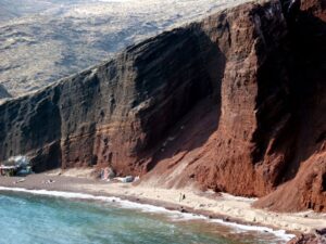
The terrain of Santorini is volcanic and bare, with a sheer coastline to the west, though in the east part of the island there are gentle beaches and small fertile plains, where many vines and garden produce are cultivated, especially tomatoes and chick-peas.
Santorini is famous for its delicious wine and tasty fava (pease-pudding).
Geographical & Historical Outline of Santorini
The island was originally called Kallisti, because of its beauty, and Strongyli (from its shape before the destruction).
The name Thera was given to the island by the Dorians who colonized the island under their leader Theras at the beginning of the first millennium BC.
The name Santorini is Venetian in origin and became established during the Frankish period. It is a corruption of Santa Irene (Agia Irini), the name of one of the churches on the island.
Santorini was inhabited from the third millennium BC.
About 1500 BC there was an enormous eruption of the volcano that not only literally fragmented the island, but also put an end to its progress and prosperity.
During the Persian Wars the inhabitants came under Persian domination.
In Byzantine times, the island was part of the theme of the Aegean and in 1207 was captured by the Venetians.
It was during this time that the island was named Santorini, after Santa Irini. After a terrible raid by Hairedin Barbarossa in 1537, it was ceded to the Turks.
During the Frankish period, several of the islanders converted to Catholicism and built many Catholic churches on the island.
The island finally gained its independence in 1821 and joined the Greek Republic in 1830.


