Informations about Amorgos
Geographical & Historical Outline of Amorgos
Amorgos lies at the south-east edge of the Cyclades group.
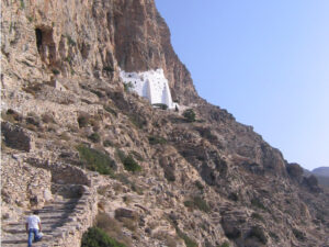
It has mountainous terrain, the highest peak being Krikelo (820 meters) and there are small valleys amongst the hills.
The east coach is rocky, while on the west there are several small, quiet bays that are ideal for swimming.
The island has two harbors: Katapola and Aegiali.
The most important archaeological finds from excavations on the island shows that Amorgos was one of the most active centers of Cycladic civilization.
Minoa, one of the main ancient cities on the island, took its name from the Minoans who conquered it.
Another important ancient city was Arkesine, a colony settled by Ionians from Naxos.
During the Frankish period, the island was abandoned, the inhabitants seeking refuge on Naxos and Crete.
Informations about Amorgos
HOW TO GET THERE
Amorgos is connected with the ports of Piraeus and others Cyclades islands by ferry boat or by high speed ferry.
The ferries dock either in Katapola or Aegiali.
The trip lasts from 7 to 11 hours by conventional ferry and 4 to 5 hours by high speed ferry.
USEFUL PHONE NUMBERS
- Municipality of Amorgos
Tel: + 30 22853 60201
dimos.amorgos.gr
- Police Station
Chora, Amorgos
Tel: + 30 22850 71210
- Port Authority of Piraeus
Tel: + 30 210 4226000 – 4
- Port Authority of Aegiali Amorgos
Tel: + 30 22850 73620
- Port Authority of Katapola Amorgos
Tel: + 30 22850 71259
- Post Office of Amorgos
Tel. : + 30 22850 71250
- Post Office
Aegiali
Tel: + 30 22850 73037
- Post Office
Katapola
Tel: + 30 22850 71496
- Medical Center
Chora, Amorgos
Tel: + 30 22850 71207
- Rural Clinic of Aegiali
Tel: + 30 22850 73222
- Rural Clinic of Arkesini
Tel: + 30 22850 72250
- Rural Clinic of Katapola
Tel: + 30 22850 71805
- Rural Clinic of Tholaria
Tel: + 30 22850 73390


