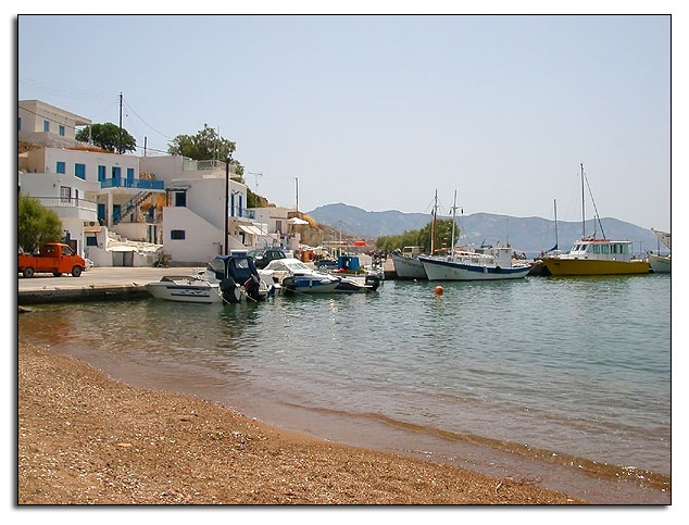
Informations about Kimolos
Geographical & Historical Outline
Kimolos is a small, barren, mountainous island to the north-east of Milos, from which it is separated by the Kimolos Straits, a narrow channel about one nautical mile wide.
It has an area of 37 square kilometers.
There are two settlements on the island: CHORIO or Kimolos in the interior and PSATHI.
It is a good place for a peaceful holiday.
Its name goes back to very early times and, according to mythology, derived from its first settler, who was called Kimolos.
It was famous for its fuller’s earth, which has been exported since ancient times, the quarries for which are in the north of the island.
Kimolos was called “Argentiera” by the Venetians, and takes its name from the Greek word “Kimolia”, which means chalk.
Both names recall the white rocks of the Island.
Echinousa is also a recorded name of the island, during the ancient times, probably because of the snake Echidna (viper), being common even today on the island.
Along with the rest of Greece, it was ruled by Ottoman Empire, until 1829, when it was annexed by the Greek state along with the rest Cyclades.
Informations about Kimolos
HOW TO GET THERE
Kimolos is connected by ferry boat or speed boat with Piraeus and with some of the Cyclades islands.
Distance from Piraeus 87 nautical miles (4,5 to 7,7 hours).
USEFUL PHONE NUMBERS
- Archaeological Museum of Kimolos
Tel: + 30 22870 51291
Fax: + 30 22870 51719
- Municipality of Kimolos
Tel: + 30 22870 51218
Tel: + 30 22870 51768
kimolos.gr
- OTE Phone Company
Tel: + 30 22870 51499
- Police Station of Kimolos
Tel: + 30 22870 51205
- Port Authority of Kimolos:
Tel: + 30 22870 51071
- Port Authority of Piraeus
Tel: + 30 210 4226000
Tel: + 30 2132147600
- Post Office of Kimolos
Tel: + 30 22870 51304
- Medical Center of Kimolos
Tel: + 30 22870 51222


