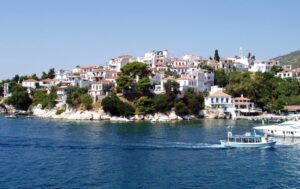
Skiathos Geographical & Historical Outline
Skiathos lies to the north-east of Evia and east of the coast of Mount Pelion in Magnisia.
It has an area of 49 square kilometers and 44 kilometers of coastline.
The island has enchanting country sides with thick pine woods coming down to the golden sandy beaches.
The sea is one of the main reasons for visiting Skiathos.
It has an emerald limpidity with an intense shade of darks green from the reflections of the trees that almost dip their branches in it.
The modern town, which was first inhabited after the liberation of the island from the Turks and its annexation to the New Greek state, is built on the ruins of ancient Skiathos.
Skiathos Geographical & Historical Outline
The earliest inhabitants of the island were Ionians, followed by the Chalkidians.
Skiathos took part in the Persian Wars as a member of the Athenian Confederacy and in 220 BC came under the control of the Macedonians, having previously been looted and abandoned.
It was later conquered by the Romans.
Christianity spread to the island under the Roman Empire.
During the period of Frankish rule it belonged to the Gizi family, like the other Sporades islands.
At this period it had fallen into obscurity on account of the repeated piratical raids it suffered.
When it was captured by the Turks in 1538, the inhabitants established themselves at an impregnable site at the north-west end of the island, which they fortified with a castle.
Skiathos was liberated in 1830, along with the other islands.

